Warning
On this page, we will try to understand why reliable and precise time-measuring instruments were essential for finding one's position at sea in past centuries.
I am not a specialist in navigation, and this is not intended as a navigation lesson.
Earth coordinates
Let's quickly refresh a few simple ideas.
To define a point accurately on Earth's surface, we use latitude and longitude.
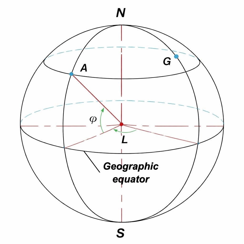
Latitudes are referenced to the equatorial plane, perpendicular to the N-S polar axis.
Longitudes are referenced to a meridian plane, defined by point A and the N-S polar axis.
A meridian is the circle on Earth's surface defined by that meridian plane. Since 1884, the meridian through Greenwich Observatory (G) has been used as the prime meridian.
Longitude (L) is the angle between the local meridian and Greenwich meridian. It is measured in degrees and minutes, then labeled east (E) or west (W) of Greenwich.
Latitude is the angular distance from the equator, measured in degrees and minutes, and labeled north (N) or south (S).
For example, Paris coordinates are 48°52' N (latitude) and 02°20' E (longitude).
Measuring latitude
We will start with two small experiments.
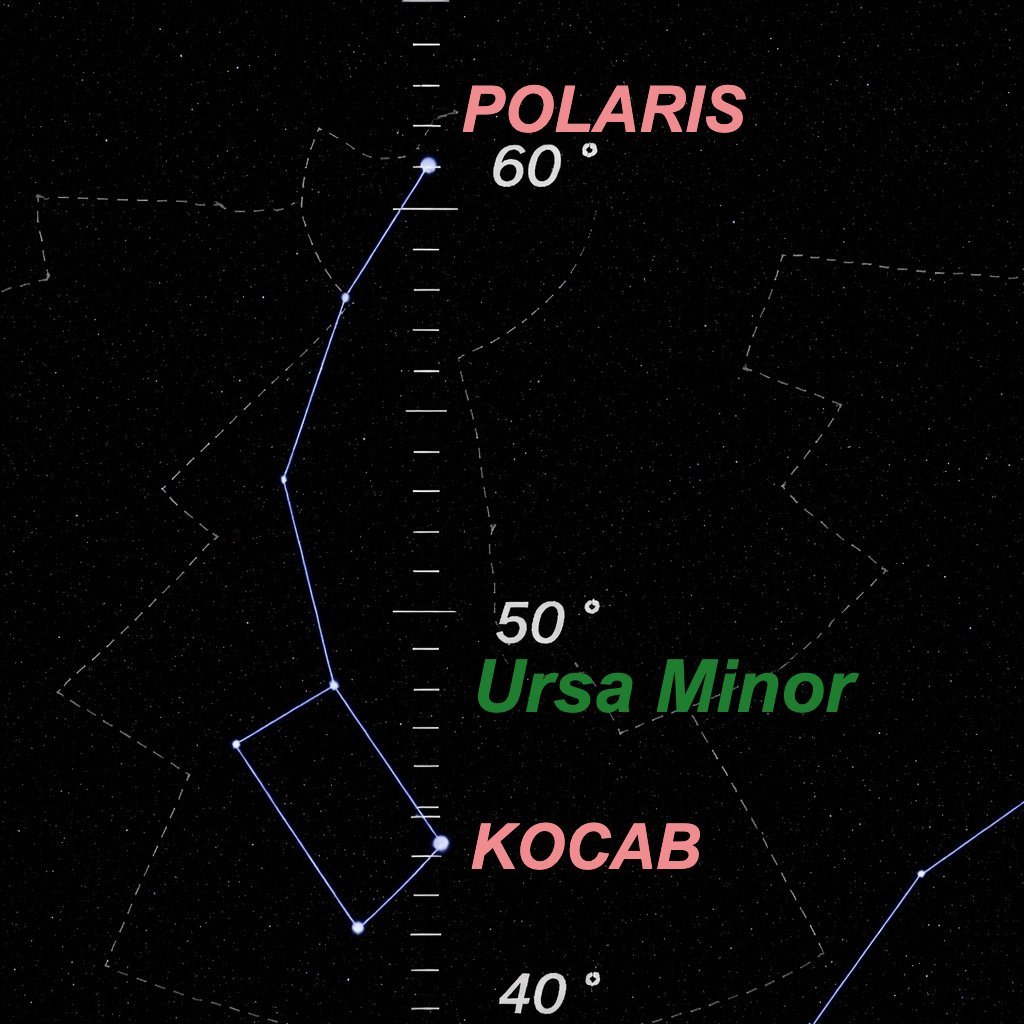
1) Using astronomy software (here, the excellent free Winstars by Franck Richard, available here, which can display star altitude), let's compare Polaris altitude in two cities (same date and time) at the same latitude.
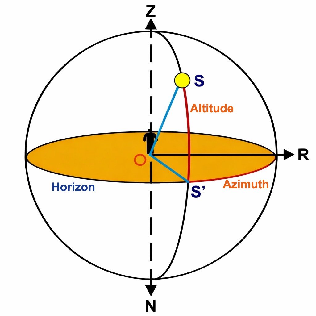
Remember: altitude starts at the local horizon and runs from 0° to 90° toward the zenith. So we have 0° at the horizon, 90° directly overhead. In the image, altitude is angle SOS.
How does the night sky look in those two cities?
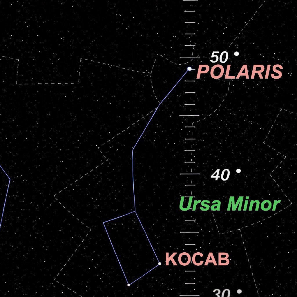
In Brest (France) 48°23' N 4°30' W Polaris altitude is about 49°
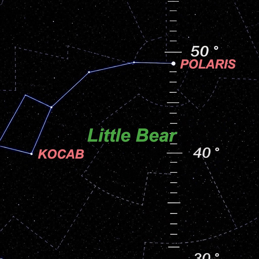
In Port Rexton (Labrador, Canada) 48°23' N 53°21' W Polaris altitude is about 49°
2) Using the same software, let's compare Polaris altitude for two cities with the same longitude but different latitudes.
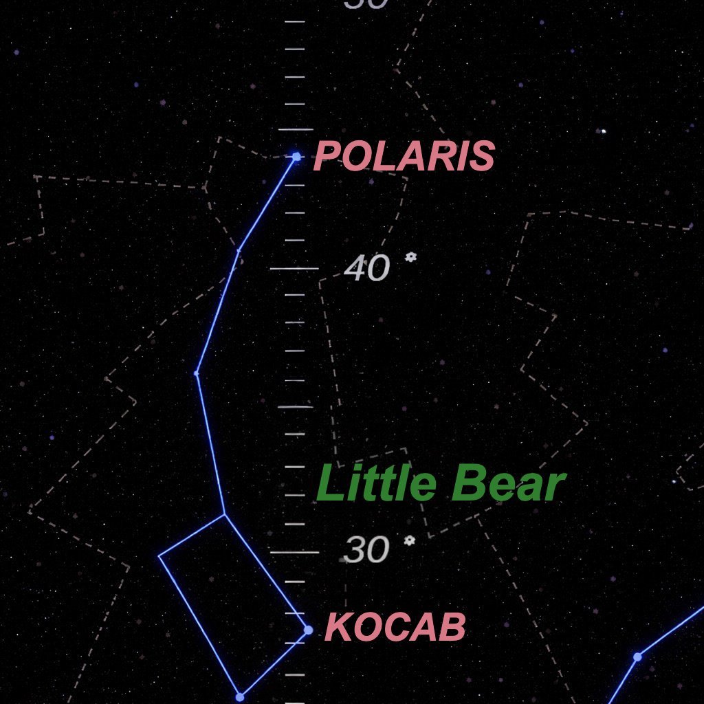
In Marseille (France) 43°18' N 5°22' E Polaris altitude is about 44°
In Bergen (Norway) 60°23' N 5°22' E Polaris altitude is about 61°
What can we conclude from these simple observations?
First, Polaris altitude is the same at different longitudes when latitude is the same. Second, at equal longitude, Polaris altitude increases with latitude.
These are exactly the conclusions early navigators reached in antiquity. They knew that one degree of Polaris altitude corresponded roughly to 20 leagues (about 80 km north-south), with a typical precision around 30 km.
How can we explain this?
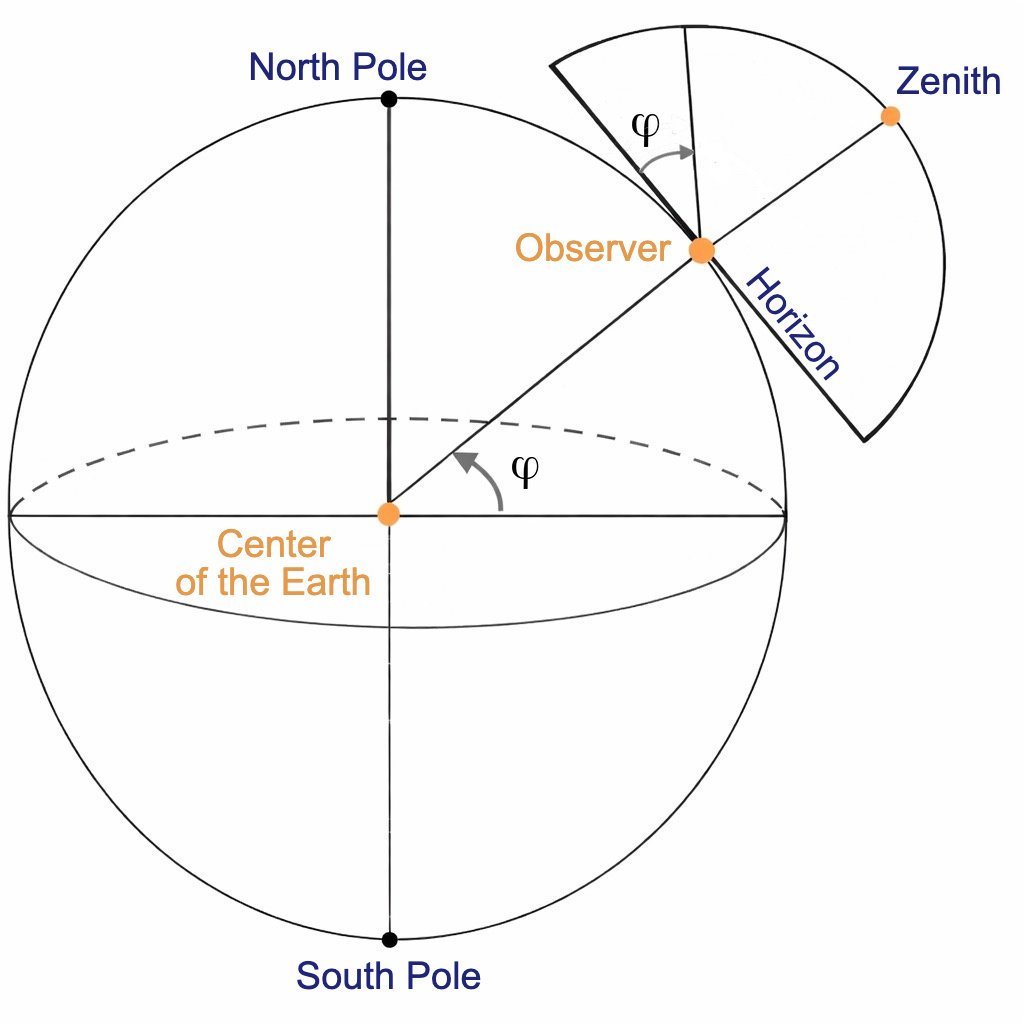
Quite simply: by sighting Polaris and measuring its angle above our horizon, it is as if we measured, from Earth's center, the angle between the center-to-North-Pole line and the equator.
So, by measuring Polaris altitude, we obtain latitude... almost.
Almost, because Polaris is not exactly on Earth's rotational axis extension.
And because aiming at the horizon at night is not easy, and especially because once you cross the equator southward Polaris is no longer visible and has no southern equivalent, navigators used the Sun instead of Polaris.
That came with an extra difficulty: the Sun's apparent yearly path around Earth is not parallel to the equatorial plane (see astronomy) and changes through the seasons, which changes its altitude through the year at the same latitude. This variation is called declination.
By the 13th century, declination tables already existed, and printing (from 1455 onward) helped spread them.
As for altitude instruments, they were many and evolved over centuries (astrolabe, nocturnal, octant, quadrant, cross-staff, etc.).
We will not describe these instruments here, because our topic is longitude calculation.
Measuring longitude
Measuring longitude is far trickier than latitude, though the solution is simple to state.
Earth rotates around its axis. So on the same parallel, the same sky phenomena are seen for Sun, Moon and stars. The only difference is timing.
So the solutions are straightforward:
- Compare observation time of a celestial phenomenon at a reference longitude with local observation time of the same phenomenon elsewhere. This method requires celestial ephemerides and belongs to astronomy.
- Keep the origin place's time and compare it with local time at the other location. This second method belongs to time-measuring instruments and is the focus of this page.
The main difficulty of the second method is building extremely precise clocks. Earth rotates 360 degrees in 24 hours. At the equator, one hour equals 15 degrees, about 1,666 km. An error of one minute of time means around 27,766 meters of positional error.
Moreover, instruments must remain extremely precise under harsh navigation conditions (humidity, heat, cold, constant motion).
These combined difficulties led Voltaire to speak of the “impossible longitude problem”; Newton was skeptical, and the rivalry between astronomical and clock-based approaches only worsened matters.
Yet from the 16th century onward, a solution became urgent because...
- longitude mattered not only for navigation but also cartography. Knowing where you are at sea is useless if you cannot place nearby land accurately.
- long maritime expeditions to India and the New World multiplied from the 16th century, driven by huge profits and high wages for captains and sailors.
- poor longitude estimates caused delays, disease, and shipwrecks.
One of those shipwrecks triggered a true “race for longitude”.
In October 1707, after victories at Gibraltar, British Admiral Cloudesley Shovell set course for England with five warships. For twelve days, they pushed through heavy fog toward the Channel.
The admiral and officers believed they were safely off Ushant. In fact, they were facing the Isles of Scilly on the night of 22 October. The flagship, Association, struck first. That night, the Crown lost three of five warships: Eagle and Romney also sank on reefs. The Isles of Scilly became a grave for 1,700 sailors.
Cloudesley survived the wreck, reached shore... and was killed by a woman passing by, who wanted and took the emerald ring on his finger.
Prompted (if one may say so, seven years later) by a petition signed by “Captains of His Majesty's ships, London merchants, and commanders of merchant vessels”, Parliament under Queen Anne passed the Longitude Act on 8 July 1714.
The Longitude Act:
- offered three prizes:
- 20,000 pounds (about 5 million euros in today's value) for a method determining longitude within 1/2 degree of great circle, corresponding to a maximum chronometer drift of three seconds per 24 hours;
- 15,000 pounds for 2/3-degree precision;
- 10,000 pounds for 1-degree precision.
- created a jury (Board of Longitude) to award prizes. The Astronomer Royal sat ex officio.
- could grant advances. By its dissolution in 1828, it had spent 100,000 pounds.
- required inventions to be tested on one of His Majesty's ships, “on the ocean of Great Britain to any port in the West Indies as Commissioners shall appoint”.
This was not the first offer. In 1598, Philip III of Spain had already offered one, unsuccessfully, to the first “discoverer” of longitude. The Dutch and French did the same. But the British prize was by far the most generous.
Wild ideas had been proposed before and after the Act.
One example: the “powder of sympathy” solution, not especially sympathetic. This powder, discovered by one Kenelm Digby, supposedly healed wounds at a distance if applied to an object involved in the wound. The treatment was said to be very painful.
Using it to find longitude was allegedly easy: wound a dog, treat it at a precise time (say noon), take the dog aboard ship, keep bloodied bandages ashore.
You see the principle. Each day at noon ashore, apply powder to bandages, dog howls from painful “distance treatment”, compare that howling noon with local ship noon, and compute longitude. The risk was that the dog might actually recover during the voyage. I am joking, of course.
The contest began, and one John Harrison entered the stage.
No one knows exactly how he learned of the prize, but the rest of his life would be devoted to it.
His life story is, in many ways, the story of longitude measurement itself, the story of a quest. I strongly recommend Dava Sobel's book Longitude, which tells Harrison's life like a novel.
Let's recall a few milestones, and the birth of the remarkable marine chronometers H1, H2, H3 and H4.
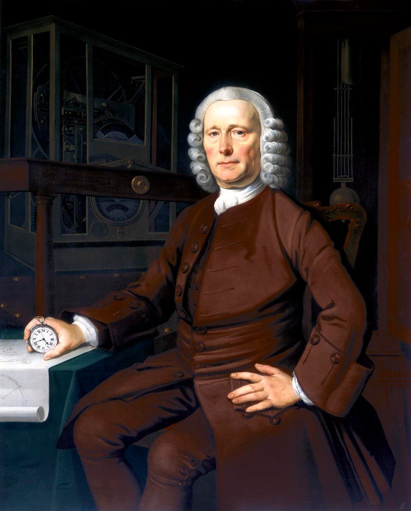
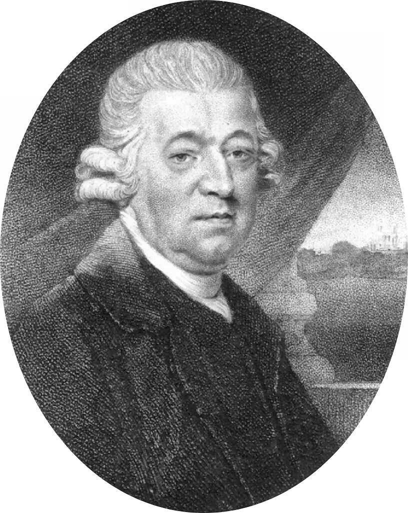
Marine chronometer versus lunar-distance method: everything set John Harrison (1693-1776), on the left, against Nevil Maskelyne (1732-1811), on the right, in the longitude race. Their scientific disagreement quickly turned into mutual aversion.
John Harrison and the prize race
John Harrison was born on 24 March 1693 in Yorkshire. His father taught him carpentry. Self-taught, John immersed himself in a manuscript copy of lectures by mathematician Nicholas Saunderson.
At not yet 20, in 1713, he built his first wooden clock with a few copper and steel parts. He exploited wood properties to the full: oak wheels, boxwood shafts and pinions, guaiacum bearings. Natural wood oils lubricated the movement without extra lubrication.
He invented a new escapement, the grasshopper escapement, and a new gridiron pendulum, temperature-stable thanks to a clever combination of metals with compensating expansion.
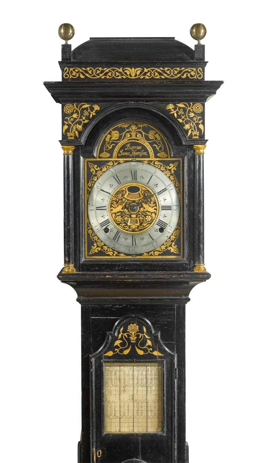
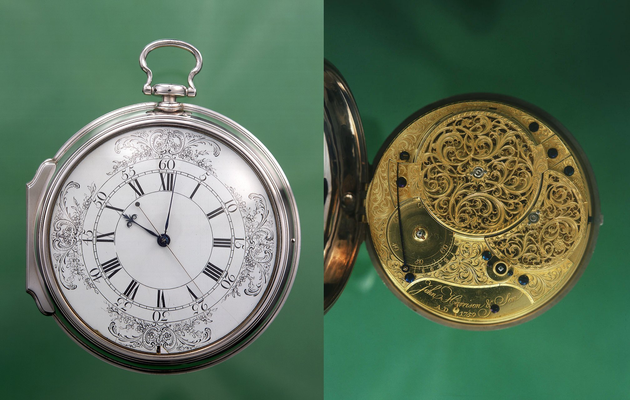
He also built several longcase clocks, one shown at right. He was assisted by his brother James, who signed the clocks.
He married in 1718. His son, born the following year, fell ill and died the year after.
He remarried in 1726 and became father to William, later his right-hand man, and Elizabeth.
He designed a new balance to replace the gridiron, which he thought unsuitable for sea conditions, and in 1730, convinced he had the technical means to build marine clocks, traveled to London to submit his project to the Board of Longitude.
But the Board had never met and had no office.
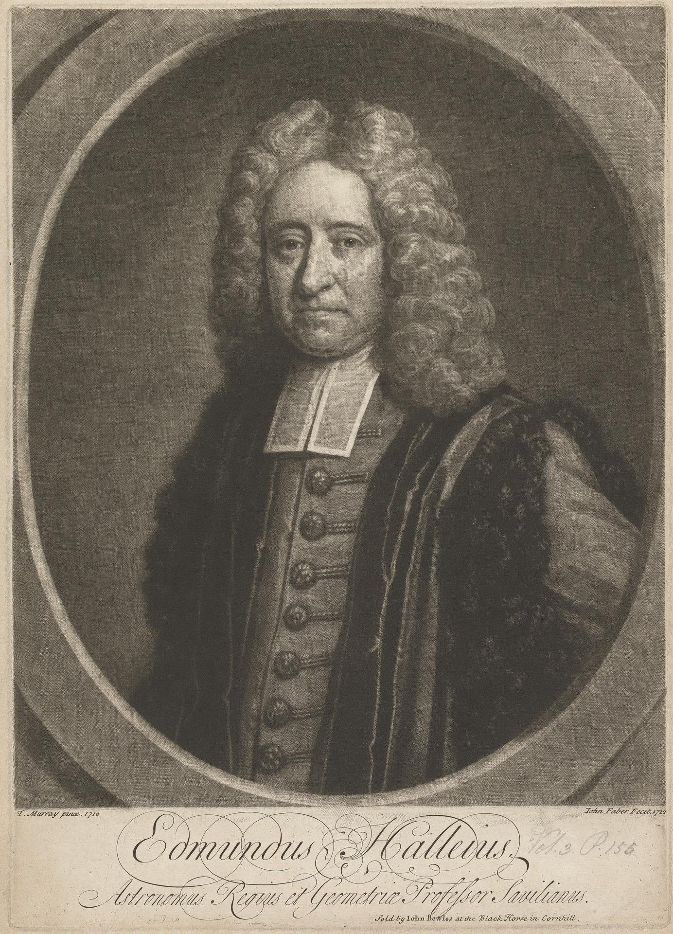
So he went to one of its members, Edmund Halley (1656-1742), discoverer of the comet trajectory bearing his name and then Astronomer Royal.
Halley was impressed by Harrison's project but knew the Board, composed of astronomers, mathematicians and navigators, would view a mechanical solution with suspicion.
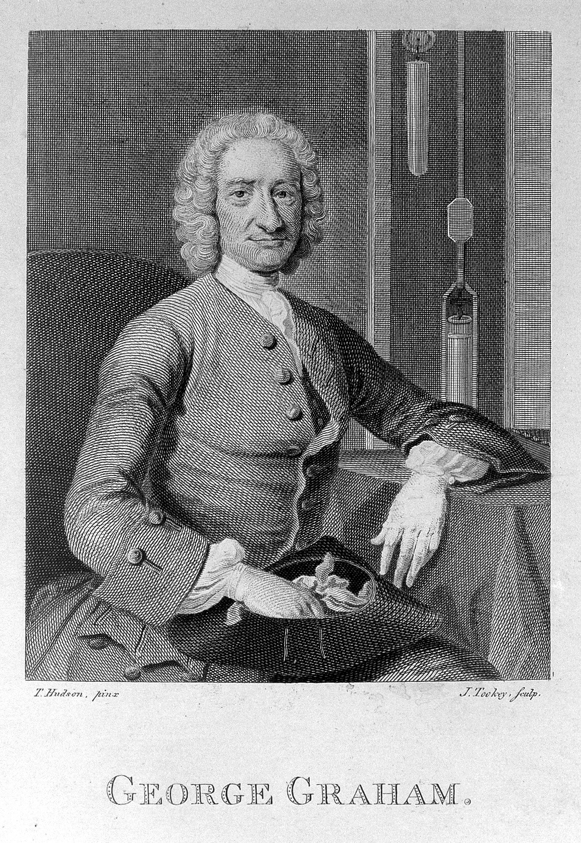
Wisely, Halley referred him to clockmaker George Graham (1673-1751).
George Graham (right) received Harrison at ten in the morning and did not let him leave until late at night, after inviting him to supper,
and after listening for hours to his project explanation.
Harrison left “Honest George” (as he was later called) with a protector and funding from Graham, without guarantee or interest.
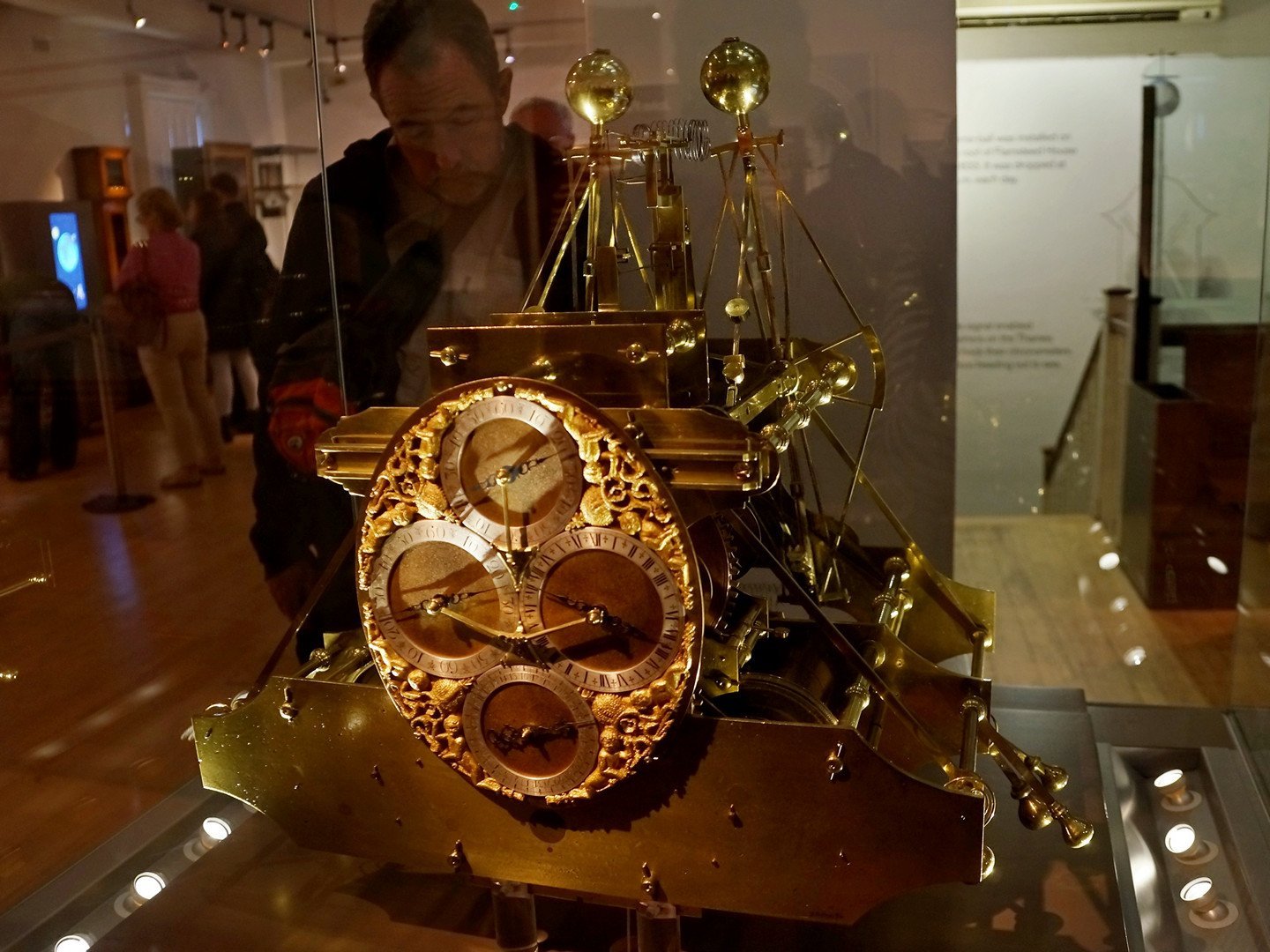
Harrison spent the next five years building H-1.
90 cm high, wide and deep, 33 kg, wooden teeth, silent grasshopper escapement, four dials (days, hours, minutes, seconds), a dense assembly of rods, springs, balls and wheels: that was H-1, without its wooden case.
And already, proven precision in a London-Lisbon trial: besides being seasick throughout, Harrison corrected the captain's dead reckoning by 140 km. For a photo, click here.
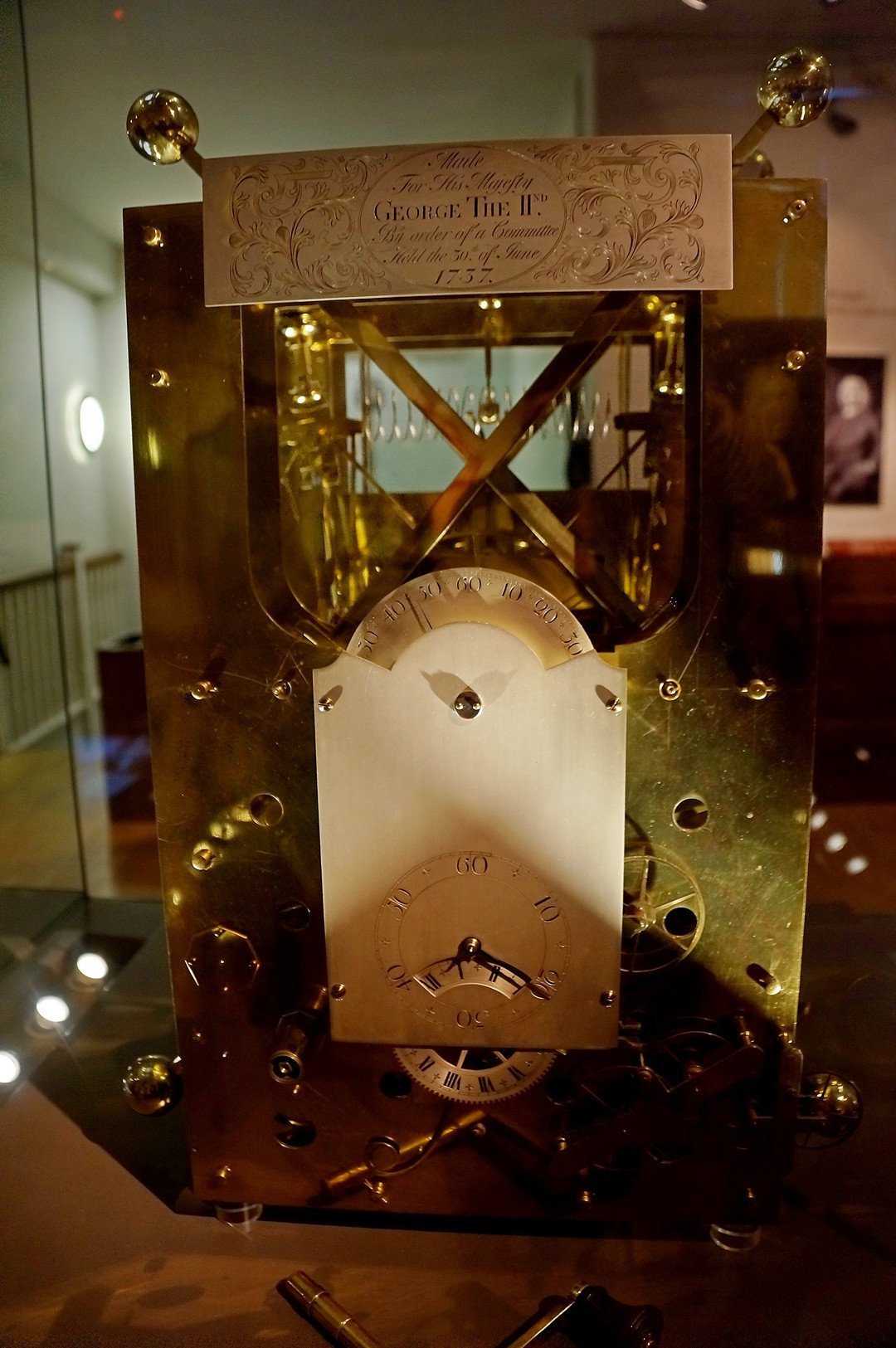
Instead of requesting the required London-West Indies trial under the Longitude Act, Harrison said H-1 still had defects and asked only for an advance to build another clock. He got it, had to add a clause requiring him, “for the public good,” to surrender both the future clock and the previous one, then returned home to start H-2.
Harrison took four years to complete H-2.
It was even heavier than H-1.
Tests subjected it to severe abuse: temperature changes, prolonged shocks, in short worse than worst sea conditions. Photos are on this page.
The Royal Society concluded that "... its movement is sufficiently exact and regular to find a ship's longitude within the strictest terms proposed by Parliament, and likely even better".
Yet it never went to sea.
Because Harrison repeated what he had done with H-1: he claimed further improvements were possible.
He wanted to build H-3 and kept requesting advances from time to time.
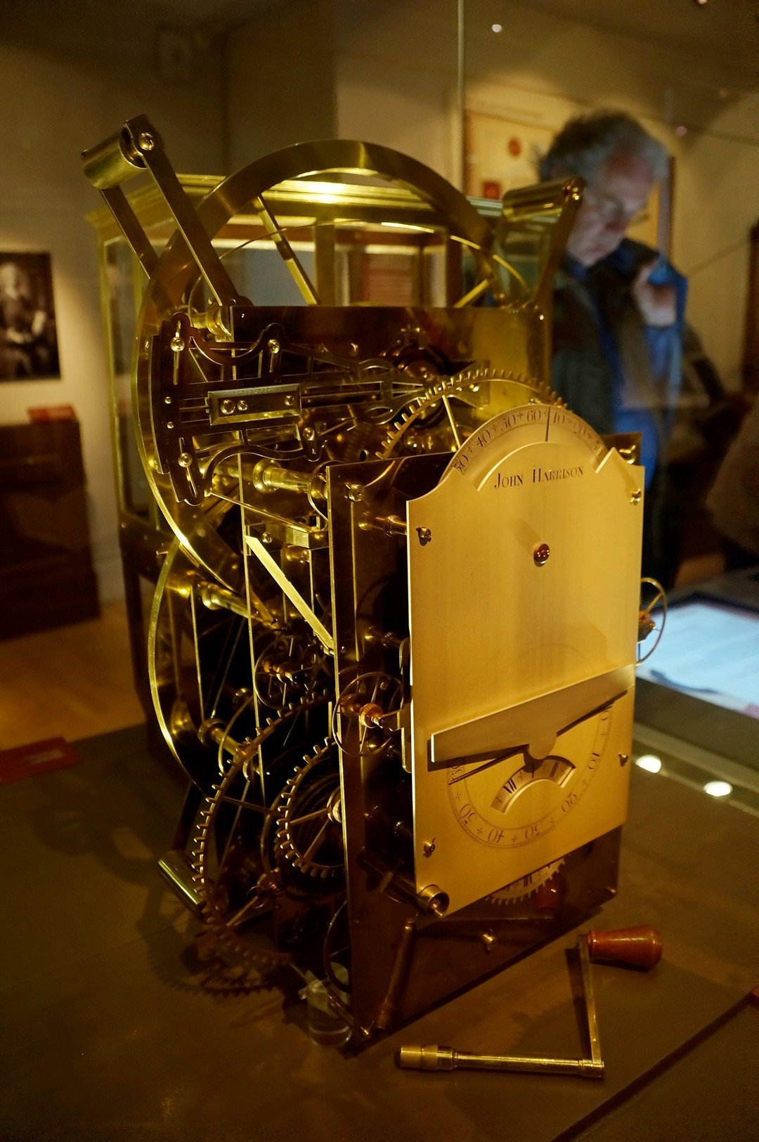
Harrison took eleven years to complete H-3.
753 parts, bimetal strip compensating temperature changes, new anti-friction system, 7 kg lighter than H-1, two circular balances, reduced dimensions: that was H-3. Photos are here.
It never saw the sea either.
Because Harrison had met watchmaker John Jefferys, who made him a pocket watch. Built from Harrison's own specifications, it achieved reliability unheard of at the time.
Harrison became convinced the future lay in “small machines” and began designing H-4.
Harrison completed H-4 in 1759.
13 cm diameter, three steel hands giving exact time, diamonds and rubies to reduce friction, 30 hours between windings: H-4 was a competition beast. See the Royal Museums Greenwich collection page for many photos.
A competition it won... almost.
Harrison was 66 when he finished it. He had to wait until age 68 for H-4 to meet Longitude Act criteria, after a London-Jamaica voyage from November 1761 to March 1762, and a second Barbados test in 1764 showing only 15 seconds lost over 5 months.
Harrison then got caught in a dispute with the Board of Longitude over payment of the promised reward.
A dispute with the Board? More accurately, a fierce struggle with Nevil Maskelyne, now Astronomer Royal. But that is another story.
And since this page focuses on time-measuring instruments, we cannot go into detail on the lunar-distance method, staunchly defended, understandably for an astronomer, by Maskelyne.
In Revolution in Time, David S. Landes writes:
“Harrison eventually got his reward, but only because King George III, himself an amateur clockmaker (like Louis XVI in France), intervened on his behalf: “By God, Harrison, I shall see you righted!” Parliament voted him the sum, yet the Board of Longitude still “cheated” him out of the 1,250 pounds previously paid for H-2 and H-3, deducting it from what was owed. A bittersweet end to the story of an extraordinary achievement.
End of story? Not quite.
Harrison died in 1776.
His marine chronometers, however, are very much alive at the National Maritime Museum, Park Row, Greenwich, London. Only H-4 is stopped, because the cleaning it would need every three years is considered too risky.
In conclusion
It must be said: the lunar-distance method also produced good results. It simply required time and four people to apply.
Since tables plus sextant cost only 20 pounds versus 100 for K3 (a “series” watch built by Kendall), those tables were used for a long time.
Did Harrison invent longitude? Certainly not. He simply invented increasingly precise instruments that made longitude calculation methods practical. Above all, he proved it was technically possible.
Few of his innovations were used later, replaced by cheaper, easier and more efficient techniques.
GPS has now replaced marine chronometers. That is no reason to forget John Harrison, who spent his life showing the way...